WEBSTER COUNTY COURTHOUSE RUINS
February 8, 2013 § 1 Comment
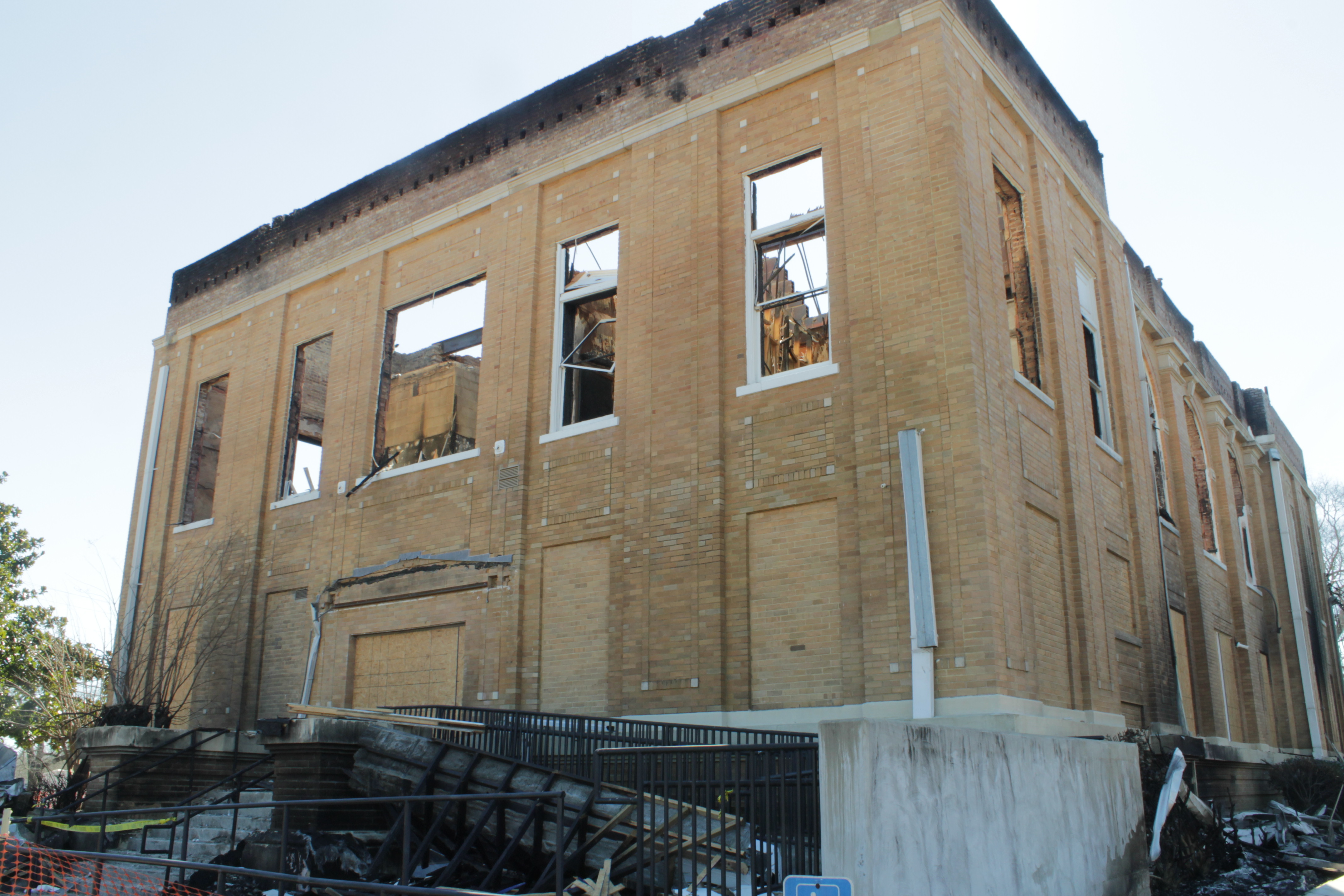
The Webster County Courthouse in the Village of Walthall, pop. 170, burned during the night of January 17, 2013. You can see some photos taken in res gestae at the Mississippi Preservation web site.
The courthouse, located in the geographic center of the county, is four miles north of the nearest town, Eupora. The village has a handful of homes, an Exxon station/convenience store, an appliance repair shop with 50-60 washers and dryers out front, a beauty salon, and a sizeable Baptist church. I stopped en route and took these pictures of the ruins.
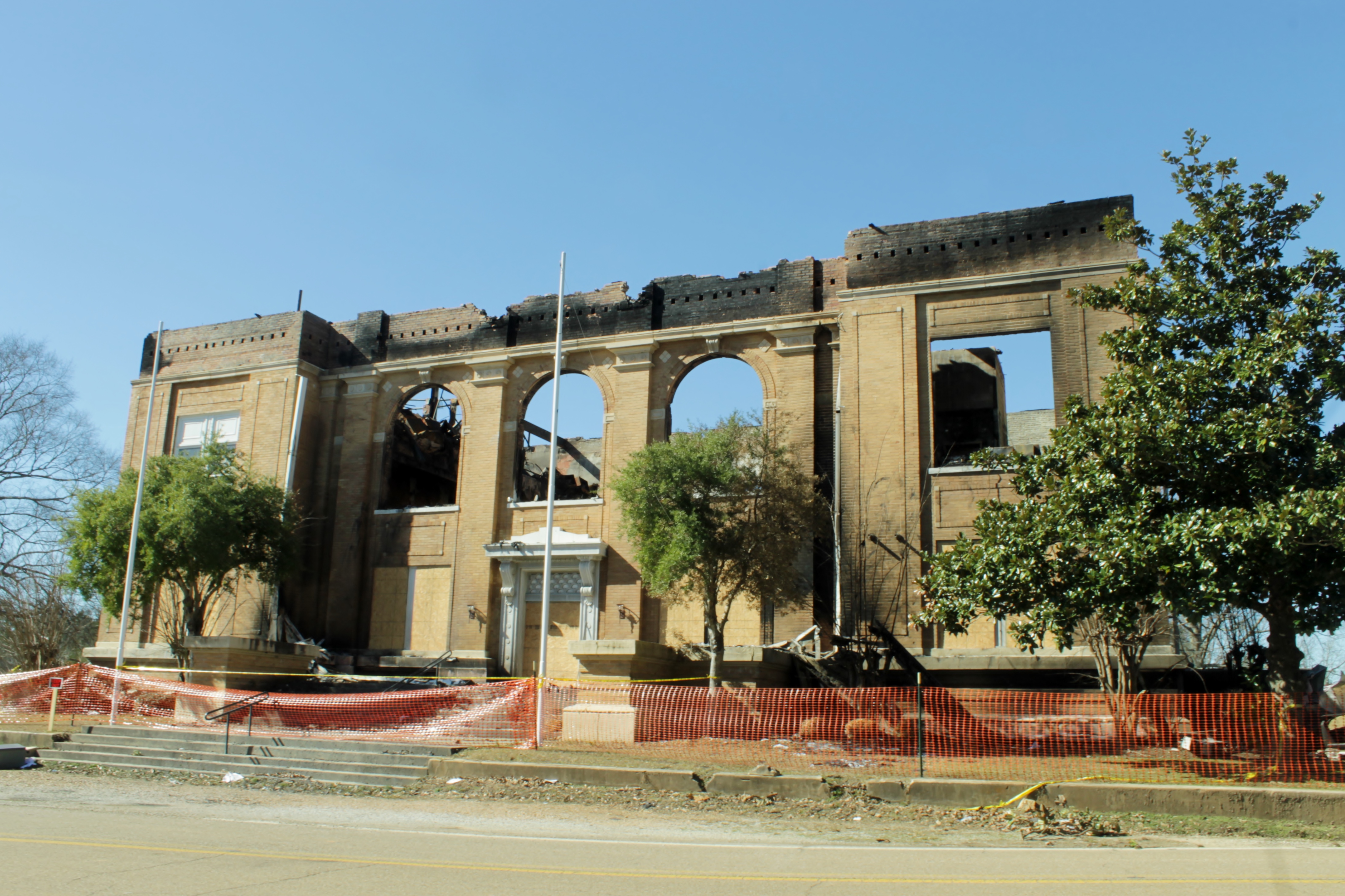
This is the front of the courthouse, with the main entrance, facing east …
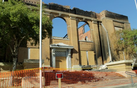
Sunlight where the courtroom was …
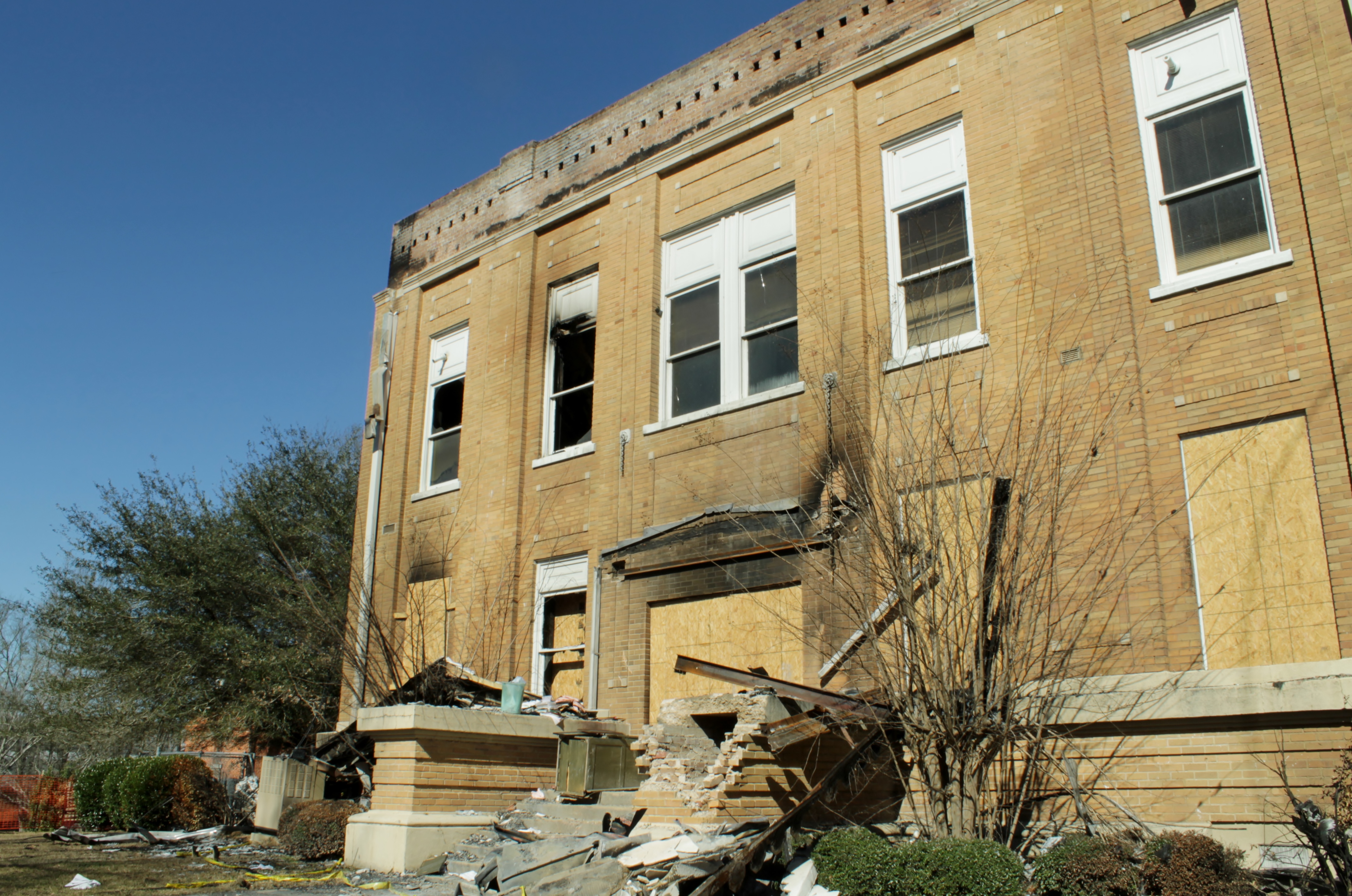
South entrance …
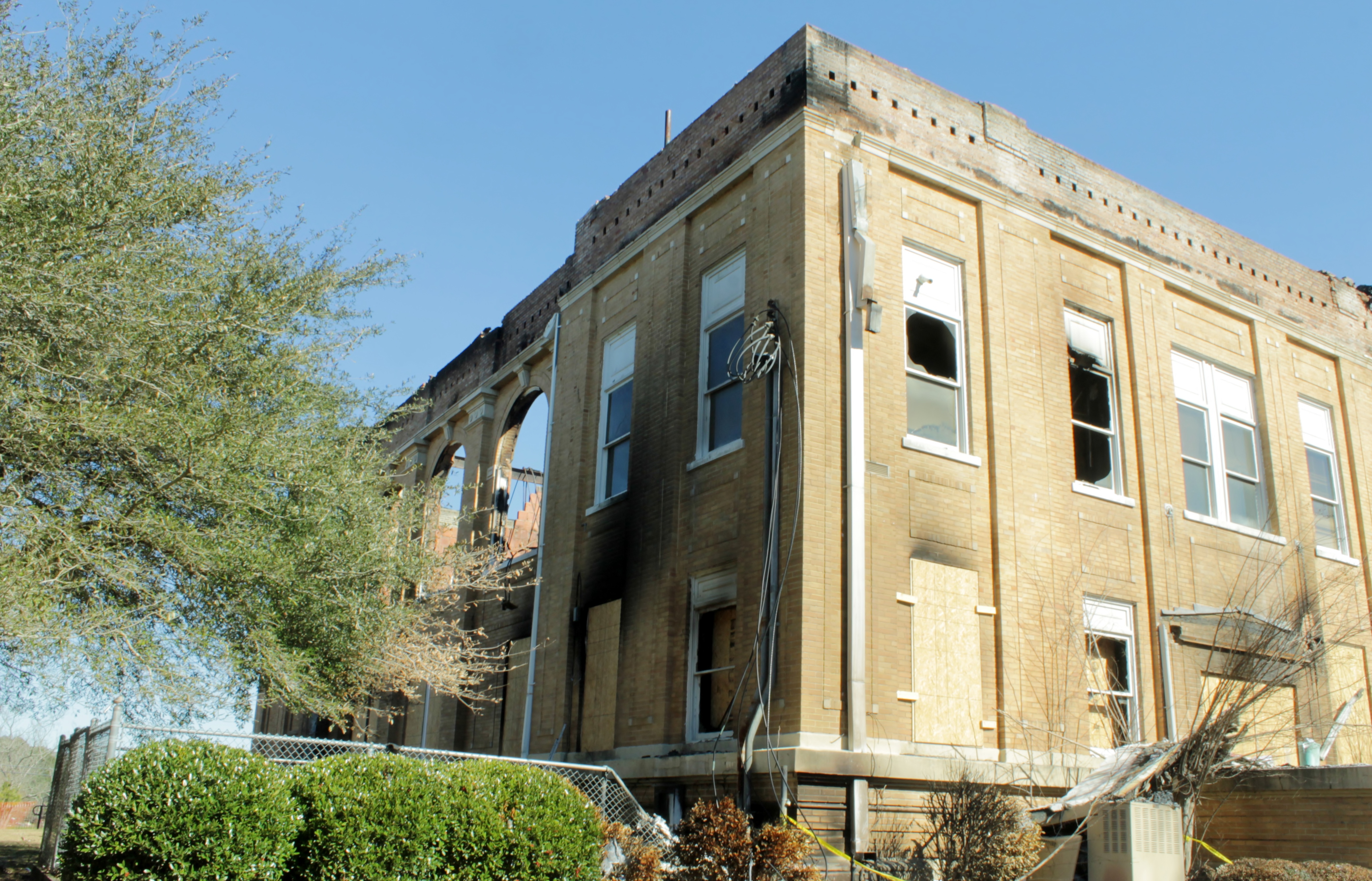
Rear, facing west …
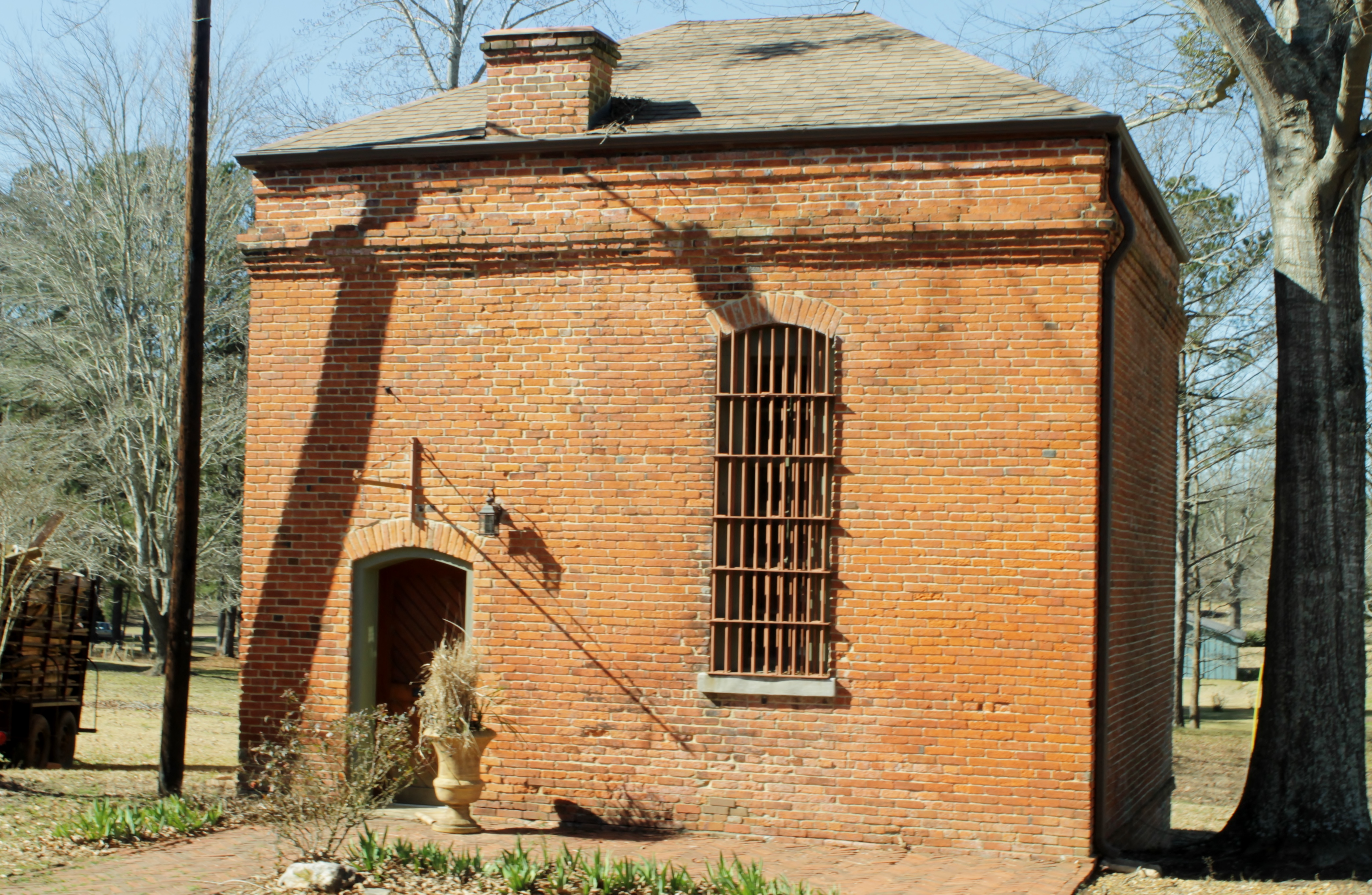
The old jail, immediately behind the courthouse, was not damaged …
North entrance …
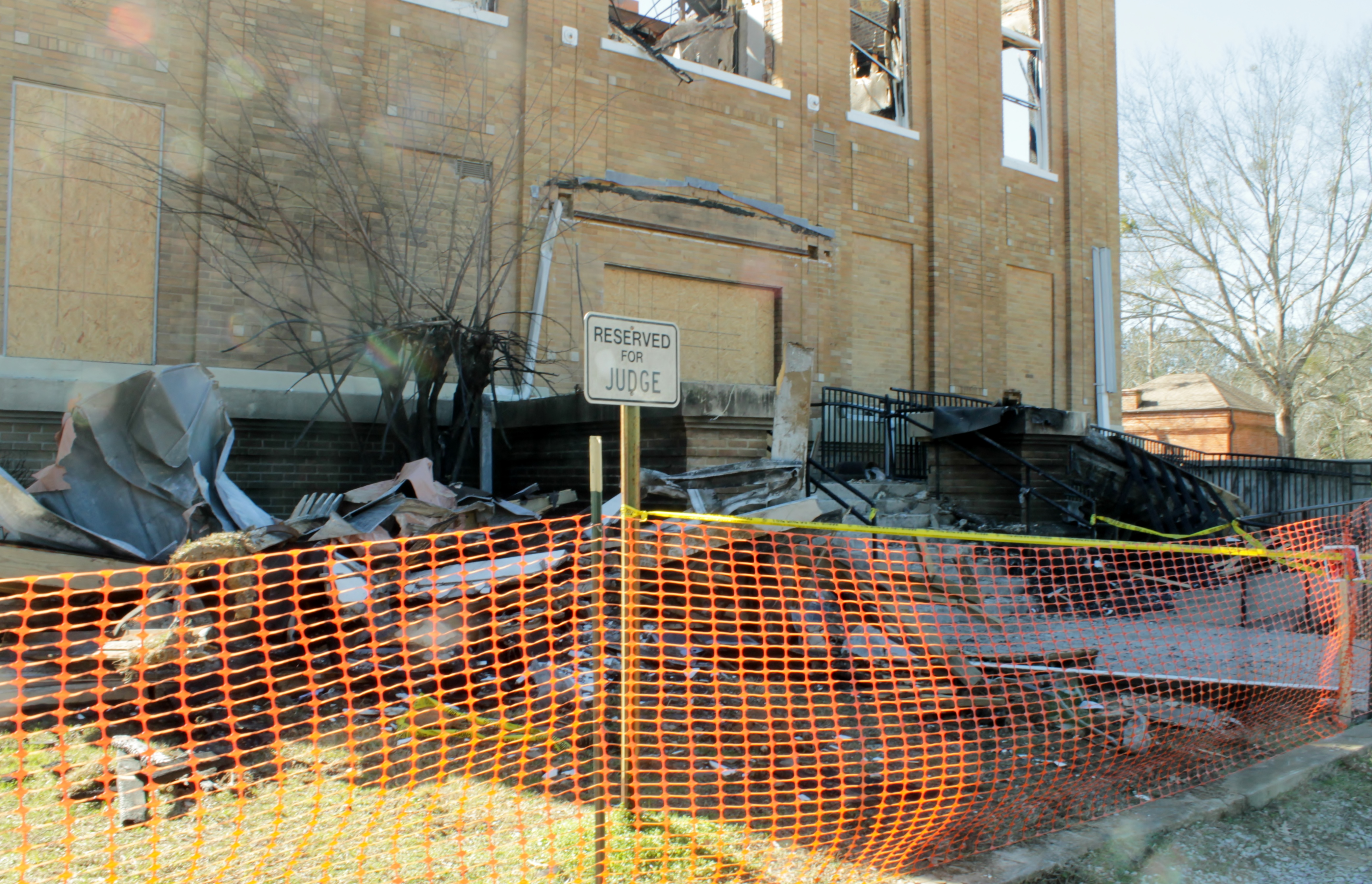
Reserved parking …
I read somewhere that the building was constructed in 1915. It was two years short of a century old when it burned.
It’s sobering to ponder what all is lost when a courthouse burns. There are the records, the furnishings, the courtrooms, the equipment, the workplaces. But there also is all of the lore and local history. Buildings can be replaced, but not their souls.
PUTTING SLAVERY ON THE MAP
January 11, 2013 § 4 Comments
I ran across a most interesting map at the Library of Congress during the holidays. It depicts the percentage of slave population of the southern states, county by county, based on the 1860 census. You can click here or on the map to see it in zoomable form.
The picture below gives you an idea of the scope and distribution of slavery in the pre-civil-war south. The darker the color, the greater percentage of slave population in the county. Washington County in the Delta, for instance, had 92% slave population, while Jones County in the southeastern piney woods, had only 12%. Mississippi’s total population of nearly 800,000 was 55% slave, and only South Carolina, with 57%, had a greater percentage of slavery.
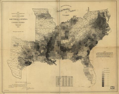
I hate to confess that I had no idea that slaves were as numerous as shown on the map. My ancestors in Vermilion Parish, LA, were poor, illiterate dirt farmers who could not afford slaves. Growing up we learned in school that the same was true of most folks in our area. Yet, when I look at the map, I am surprised that nearly a third of my Parish’s population at the time were slaves. It’s a sobering thought.
